CDE Curricula
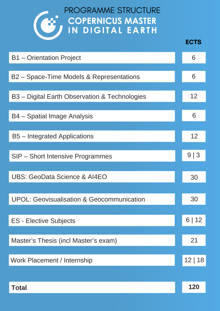
The Erasmus Mundus Joint Master curriculum is built from modules maintaining a straight total of 30 ECTS per semester. The overall Master of Science programme structure reflects the cooperation of the Higher Education partners, and is directed at supporting the key qualification objectives for a study programme which simultaneously will aim at broad-based advanced Geoinformatics, Earth Observation, Remote Sensing, Cartography, Geovisualisation, Computer Science as well as a applied emphasis on use cases with Copernicus data and services within the main Copernicus domains under a generic Digital Earth vision.

-
The obligatory work placement (internship) typically is conducted in blocked mode outside of course periods, but also can be completed as equivalent part-time activity.
-
Throughout the programme a personal ePortfolio has to be maintained. It contains individual presentations of materials resulting from coursework.
-
The specialization track is completed at one of the designated partner universities in semester 3, typically leading to a Master’s Thesis in line with the respective track during semester 4.
-
A research-based Master’s Thesis can be chosen in the context of a collaborative research work placement at a consortium partner or at any institution worldwide.
-
The Master’s Thesis is completed in collaboration with partner university supervisors.
-
A Programme Board governs all matters not under jurisdiction of individual partners, including but not limited to assignment to specialization tracks, agreement to work placement options, thesis supervision and decisions regarding short intensive programmes.
latest update: March 7, 2024


